 18 May 2013
“San Francisco: The Gateway to a Variety of Nearby Destinations”
San Francisco is an ideal launching point for discovering the many diverse communities of Northern California. With time to explore, several tourist destinations lie just a few hours away.
To help navigate the greater Bay Area, San Francisco Travel has compiled a list of top picks for day-long or multi-day excursions near San Francisco.
For more information on destinations beyond San Francisco, visit http://www.sanfrancisco.travel/beyondsf/
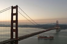
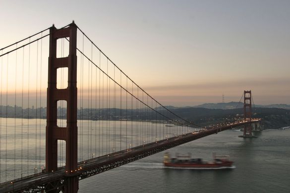
Sausalito / Marin
San Rafael, Sausalito, Tiburon, Larkspur, Pt. Reyes, Mill Valley
- Trendy restaurants and funky houseboats in Sausalito, a pristinely beautiful National Seashore area and the rugged trails of Mount Tamalpias allow Marin to live up to its nickname as San Francisco's “Riviera.”
- The wind-whipped beauty of Point Reyes National Seashore, the hiking and cycling on Mount Tamalpias (“Mt. Tam'') and the serene redwoods of Muir Woods offer a wide range of options.
- Tiburon, with its classic Main Street and central waterfront location is an ideal spot to refresh along the Bay.
- The pretty town of Sausalito spills down its hillside locale to Bridgeway, Sausalito's main drag, with its fine dining, galleries, shopping, strolling, and picture-perfect views of San Francisco across the Bay.
- Directions: Drive north on 101 across the Golden Gate Bridge. The Blue & Gold Fleet runs ferries to Sausalito, Tiburon and Angel Island State Park from Fisherman's Wharf and the Ferry Building. Golden Gate Transit operates ferries to Sausalito and Larkspur from the Ferry Building. The family-owned Angel Island-Tiburon Ferry also runs daily.
- Distance from San Francisco: 10 miles
- Drive Time from San Francisco: 30 minutes
- Climate: Mild during summer with temperatures in the 60's and cool during winter with temperatures in the 50's. The warmest month of the year is September with an average maximum temperature of 71°F, while the coldest month of the year is January with an average minimum temperature of 46°F.
Destination website: http://www.visitmarin.org/
Press contact: Christine Bohlke, christine@visitmarin.org, 415-925-2060
East Bay
Oakland, Alameda, Berkeley, Concord, Walnut Creek, Livermore, Pleasanton, Emeryville, Hayward
- Located on the sunny side of the Bay, the East Bay communities boast high-intensity pro sports, gourmet dining, and happening waterside watering holes.
- The Berkeley campus of the University of California offers a warren of shops, pubs and fast-food, along with superb bookstores and music stores.
- Slow food holds sway in Berkeley's gourmet ghetto, served with a mantra of local, seasonal and sustainable.
- Oakland is home to baseball's Athletics and football's Raiders, plus an entertaining mix of live music, pubs and boating marinas at Jack London Square and restored Victorian shops on Ninth Street.
- Directions: Bay Area Rapid Transit (BART) trains and AC Transit buses serve the East Bay from San Francisco. Take Interstate 80 over the Bay Bridge by car.
- Distance from San Francisco: 12 miles
- Drive Time from San Francisco: 20 minutes
- Climate: Mild during summer with temperatures in the 60's and cool during winter with temperatures in the 50's. The warmest month of the year is September with an average maximum temperature of 74°F, while the coldest month of the year is January with an average minimum temperature of 44°F.
Destination websites: http://visitoakland.org/, http://visitberkeley.com/
Press contacts:
Visit Oakland, Lindsay Wright, lindsay@visitoakland.org, 510-839-0560
Visit Berkeley Information Center, Dan Marengo, dmarengo@visitberkeley.com, 410-549-7040
Silicon Valley
Santa Clara, San Jose, Palo Alto, Mountain View, Foster City, Woodside
- Silicon Valley is the capital of the high tech world, housing companies such as Google (Mountain View), Facebook (Palo Alto), Apple (Cupertino), Hewlett-Packard (Palo Alto), Intel Corporation (Santa Clara), Yahoo (Sunnyvale), Microsoft Research (Mountain View) and much more.
- Much of the South Bay is steeped in innovation, from the venture capital firms along Sand Hill Road in Menlo Park to the manicured Stanford University campus in Palo Alto.
- Scientific progress is celebrated in San Jose's Tech Museum of Innovation
- Enjoyable kitschy suspense is generated in the Winchester Mystery House with its trap doors and secret passageways.
- Directions: South on highway 101 along the bayshore or Highway 280 along the ridge top heading down the Peninsula.
- Distance: 40 miles
- Drive Time: 1 hour
- Climate: Warm during summer with temperatures in the 70's and cold during winter with temperatures in the 40's. The warmest month of the year is July with an average maximum temperature of 87°F, while the coldest month of the year is December with an average minimum temperature of 38°F.
Destination websites: http://www.santaclara.org/, http://www.sanjoseca.gov/visitors.asp, http://www.city.palo-alto.ca.us/, http://www.ci.mtnview.ca.us/
Beach Communities
Half Moon Bay, Pacifica, Santa Cruz
- In just 20 minutes or 2 hours South of San Francisco, California Highway 1 links a string of beach towns, each with its own eco-system of surf shops, bait-and-tackle stands, restaurants-with-a-view, places to buy a wetsuit and spots to fill the cooler with ice.
- Seasonal whale-watching is a popular pastime and when the last wisps of summer fog burn off, the beaches fill with swimmers and surfers.
- At the northern end are Pacifica, Montara, Moss Beach and Half Moon Bay.
- Comprised of exquisite resorts, pampering day spas and wonderful dining options, Half Moon Bay offers horseback riding on the beach and whale watching from the surrounding cliffs, while those more adventurous might want to try surfing the big waves at Mavericks—home of the largest "big wave" surf competition in the world.
- About 2 hours south, Santa Cruz anchors the southern end, with its century-old Santa Cruz Beach Boardwalk—a family-friendly seaside amusement park located on a picturesque beach in a classic California surf town. Featuring dozens of ocean front thrill rides including the world-famous Giant Dipper wooden roller coaster, the hair-raising Double Shot tower, plus an 18-hole mini-golf course, award-winning arcades, and family bowling.
- Directions: Take California 1 south from San Francisco for the most picturesque drive, or take Highway 101 and pick up a connector road west to the sea.
- Distance from San Francisco: 15-70 miles
- Drive Time from San Francisco: 20 minutes–2 hours
- Climate: Mild during summer with temperatures in the 60's and cool during winter with temperatures in the 50's. The warmest month of the year is September with an average maximum temperature of 75°F, while the coldest month of the year is December with an average minimum temperature of 39°F.
Wine Country
Napa, Calistoga, Sonoma, Glen Ellen, St. Helena, Yountville, Petaluma, Santa Rosa, Mendocino, Healdsburg, Geyserville, Bodega Bay
- Napa is about an hour north of San Francisco on I-80.
- While it's considered the most upscale of Northern California's three wine-growing regions, there are options for every vacation style, whether you want to bicycle from vineyard to vineyard or arrive in style in a private limousine.
- Home to more than 400 wineries, which are within spitting distance of one another, Napa is ideal for those who want to visit many wineries in one trip.
- For classic glamour, you can't beat the Napa Valley Wine Train, with its early 20th-century rail cars, gourmet meals and, of course, local wines. Book a trip that includes a stop-off winery tour, or simply sit back and enjoy the ride.
- Half an hour west of Napa (and a little more than an hour north of San Francisco), rustic Sonoma exhibits a decidedly more bohemian and agricultural vibe. Sonoma County alone is the size of Rhode Island and has about 170 wineries that tend to be intimate and often family-owned a bit more spread out than those in Napa.
- Start in the town of Sonoma, wandering around shops, cafes and tasting rooms. Pick up a bottle or two of the varietals you like best, and then head for an artisan food market for locally produced cheese, baguettes and charcuterie. Head to the historic plaza for a picnic under the trees.
- Directions: Drive north on 101 over the Golden Gate Bridge for Santa Rosa and Mendocino. Branch east to Sonoma on Highway 121; continue east to Highway 29 for Napa and continue north to Yountville, Calistoga and Kelseyville in Lake County.
- Distance from San Francisco: 50-55 miles
- Drive Time from San Francisco: 1-2 hours
- Climate: Mild during summer with temperatures in the 60's and cold during winter with temperatures in the 40's. The warmest month of the year is July with an average maximum temperature of 82°F while the coldest month of the year is December with an average minimum temperature of 38°F.
Destination websites:
http://www.visitnapavalley.com
http://www.sonomacounty.com/
Press contacts:
Napa: Allison Simpson, allison@legendarynapavalley.com, 707-226-5813
Sonoma: Birgitt Vaughan, publicrelations@sonomacounty.com, 707-522-5826
Destination websites:
http://www.visithalfmoonbay.org/
http://www.visitpacifica.com/
http://www.santacruzca.org/
Press contacts:
Half Moon Bay: 650-726-8380
Pacifica: Lauren Eastman & Associates, 415-867-7664
Santa Cruz: Christina Glynn, Santa Cruz County CVB, cglynn@santacruz.org
Monterey / Carmel
- Two hours south of the Bay Area along the coast, the famous fishing town of Monterey, anchored by the renowned Monterey Bay Aquarium.
- Visitors find historical charm, scenic views and sustainable seafood at Cannery Row, downtown's historic adobes and Fisherman's Wharf.
- Minutes away, Carmel-by-the-Sea is a gorgeous beachside town of historic hotels and cozy inns, hidden cottages and eccentric artist studios, fine restaurants, one-of-a-kind shopping and picturesque landscapes.
- Next door, Pebble Beach features the world-famous Pebble Beach Golf Links and the picturesque 17-Mile Drive.
- Follow Highway 1 south through Big Sur, a stretch of road that has justly earned its title as the most scenic drive in America, to San Simeon's legendary Hearst Castle.
- Enjoy hundreds of thousands of acres of regional, national and state parks, including the infamous Pfeiffer Big Sur State Park
- Directions: South on Highway 280, through the Santa Cruz Mountains and connect with California 1 to Monterey and Carmel.
- Distance from San Francisco: 115-125 miles
- Drive Time from San Francisco: 2-2.5 hours
- Climate: Warm summers and mild winters. Spring is a pleasant season with little rainfall and warm temperatures. The summer climate features typically warm weather, although morning fog can be widespread and cold. Temperatures peak at 70°F during September and October. ,
Destination website: http://www.seemonterey.com/
Press contact: Colleen Chen, See Monterey, colleen@mccvb.org, 831-657-6415
Sacramento
Sacramento, Vacaville, Vallejo, Fairfield
- Sacramento is home to California's dignified Capitol Building and a lovingly preserved Gold Rush district
- Peacefully located in a leafy valley of scenic rivers and canopies of trees, Sacramento is a convergence of tall, gleaming buildings, hearty Victorians, splendid restaurants and shops, and a vibrant arts scene.
- The Golden State's capital city was the western terminus of the transcontinental railroad of pioneer days, and parts of the city still have an Old West ambience.
- Old Sacramento preserves lovingly restored 19th century saloons and shops.
- The renovated, copper-domed Capitol Building is an elegant showcase for state government.
- Directions: From the Bay Bridge, take I-80 east to Sacramento. Amtrak's Sacramento bound Capitol Corridor trains connect via shuttle from the Ferry Building to the depot in Emeryville.
- Distance from San Francisco: 90 miles
- Drive Time from San Francisco: 2 hours
- Climate: Warm during summer with temperatures in the 70's and cold during winter with temperatures in the 40's. The warmest month of the year is July with an average maximum temperature of 92°F, while the coldest month of the year is December with an average minimum temperature of 37°F.
Destination website: http://www.discovergold.org/
Press contact: Lucy Steffans, Sacramento CVB, lsteffens@cityofsacramento.org, 916.808.5553
Yosemite / Central Valley
Stockton, Fresno, Lodi, Merced, Yosemite, Fish Camp
- 4-5 hours East of San Francisco lies Yosemite National Park, with soaring mountains, towering trees, crystal-clear waters, snow skiing, hiking trails, and more
- One of the crown jewels of America's national park system, Yosemite National Park rises dramatically east of the flat, fertile Central Valley four hours from San Francisco and encompasses of 1,170 square miles of extraordinary beauty.
- Open year-round, the park features glacier-carved valleys, large waterfalls, alpine peaks and lakes, meadows, wildlife, towering rock cliffs and granite domes.
- Activities vary by season and include hiking, camping, fishing, bicycling, horseback riding, ice skating and snow skiing
- Driving the Central Valley on Interstate 5, it would be easy to miss the valley's importance. Four hundred miles long and flanked by mountain ranges, this irrigated, intensively cultivated basin has been called the greatest garden in the world.
- Directions: East from San Francisco over the Bay Bridge, south on Highway 880, east on 580 and 205 to Manteca, south on 99 to 120, east on 120 to the northwest gate of Yosemite National Park.
- Distance from San Francisco: 80-160 miles
- Drive Time from San Francisco: 2-4 hours
- Climate: Warm during summer with temperatures in the 70's and cold during winter with temperatures in the 40's. The warmest month of the year is July with an average maximum temperature of 98°F, while the coldest month of the year is December with an average minimum temperature of 36°F.
Destination website: http://www.yosemiteexperience.com/
Press contacts:
Lisa Cesaro, DNC Parks & Resorts at Yosemite, Inc., lcesaro@dncinc.com, 209-372-1445
Scott Gediman, Yosemite Public Information Office, scott_gediman@nps.gov, 209-372-0248
Mendocino County
Anderson Valley, Upper Russian River Valley, North Mendocino Coast, South Mendocino Coast, North Mendocino County
- 3-4 hours North of San Francisco is Mendocino County, where rugged coastline, breathtaking beaches, and picturesque villages meet majestic redwood forests and America's Greenest Wine Region.
- Take ascenic drive through Anderson Valley, past grazing sheep, apple orchards, olive groves, roadside fruit stands and world class wineries surrounded by wooded hillsides.
- Upper Russian River Valley is known for its wine-friendly climate and small town feeling. The region boasts cozy bakeries, farmer's markets, tree-lined streets, and a variety of shops as well as some of the oldest vineyards in Mendocino.
- The North Coast is the most visited region of Mendocino, boasting a large concentration of first-rate inns and restaurants. The area is host to numerous state parks, which showcase coves, tide pools, redwoods and waterfalls.
- Mendocino Village is a Victorian gem, while Fort Bragg is a turn-of-the century town with a working port.
- Directions: From the Golden Gate Bridge, head North on 101, through Santa Rosa to Rte.128, through the Anderson Valley Wine Country, to Rte. 1
- Distance from San Francisco: 160 miles
- Drive Time from San Francisco: 3 hours
- Climate: Cool during summer with temperatures in the 50's and cold during winter with temperatures in the 40's. The warmest month of the year is September with an average maximum temperature of 67°F, while the coldest month of the year is December with an average minimum temperature of 39.°F
Destination website: http://www.visitmendocino.com/
Press contact: Mark Sejvar, HypeHouse, Inc. for Visit Mendocino County, mark@hypehouse.com, 415-788-4114
Lake Tahoe
North Lake Tahoe, South Lake Tahoe
- Alpine coolness, fresh-air forests and sparkling blue water distinguish Lake Tahoe, nested in the Sierra Nevada range.
- During summer, visitors can enjoy swimming, boating, fishing and gambling as well as the many restaurants, lodges, hotels and casinos of South Lake Tahoe and Incline Village, NV.
- In winter, the area boasts some of the best skiing and snowboarding in the West and includes top ski areas such as Heavenly and Squaw Valley.
- Directions: From the Bay Bridge, take I-80 east to Lake Tahoe.
- Distance from San Francisco: 200 miles
- Drive Time from San Francisco: 4.5 hours
- Climate: Cool during summer with temperatures in the 50's and very cold during winter with temperatures in the 20's. The warmest month of the year is August with an average maximum temperature of 78°F, while the coldest month of the year is December with an average minimum temperature of 14°F.
Destination websites: http://tahoesouth.com/, http://www.gotahoenorth.com/
North Coast / Mount Shasta
Redding, Shasta, Red Bluff
- 5 hours North of San Francisco, visitors enjoy the North Coast's hillside highways of breathtaking beauty and hidden coves that flare into beaches.
- Within a 50 mile-wide strip stretching the entire length of the California coast past Eureka to the Oregon border, a living symbol of California, the Coast Redwood, flourishes in quiet glens and in welcoming state parks.
- The snow-streaked volcanic peak of Mount Shasta rises abruptly, almost theatrically, near Interstate 5. Topping 14,000 feet, Shasta is a favored destination for climbers.
- Directions: Go north from the Golden Gate Bridge up California 1 for panoramic coast views. Highway 101 is a faster route north to the redwoods. Mount Shasta is just east of I-5, several hours from The City.
- Distance from San Francisco: 250 miles
- Drive Time from San Francisco: 5 hours
- Climate: Mild during summer with temperatures in the 60's and very cold during winter with temperatures in the 30's.The warmest month of the year is July with an average maximum temperature of 83°F, while the coldest month of the year is December with an average minimum temperature of 25°F.
The San Francisco Travel Association is the official tourism marketing organization for the City and County of San Francisco. For information on reservations, packages, activities and more, visit www.sanfrancisco.travel or call 415-391-2000. The Visitor Information Center is located at 900 Market St. in Hallidie Plaza, lower level, near the Powell Street cable car turnaround.
For an insider's perspective, join more than 500,000 people who follow San Francisco Travel on Facebook at www.facebook.com/onlyinsf and more than 100,000 who follow “OnlyinSF” on Twitter at http://twitter.com/onlyinsf.
American Express® is the official Card partner of the San Francisco Travel Association.
San Francisco International Airport (SFO) offers non-stop flights to more than 31 international points on 30 international carriers. The Bay Area's largest airport connects non-stop with 75 cities in the U.S. on 15 domestic airlines. For up-to-the-minute departure and arrival information, airport maps and details on shopping, dining, cultural exhibitions, ground transportation and more, visit flysfo.com. Follow SFO on twitter.com/flysfo and facebook.com/flysfo.
# # #
Note to editors: Photos and press releases are available at http://www.sanfrancisco.travel/media/.